
 Back to home
Apple Maps Accessibility
The what
As a wheelchair user, journey planning is a problem I navigate myself. So when an assignment on my UX design course asked me to propose improvements to an existing app, I chose Apple Maps and an accessibility feature.
Apple already design for accessibility across speech, vision, hearing, mobility and cognition, which made Maps a natural place to extend that work to route planning.
The why
As a long-standing user of Apple products, I decided to focus on some development proposals to improve the existing accessibility features in Apple Maps.
Accessibility and mobility needs vary from person to person. Further detail, customisation and development in the app could therefore be improved to assist the wider demographic.
The how
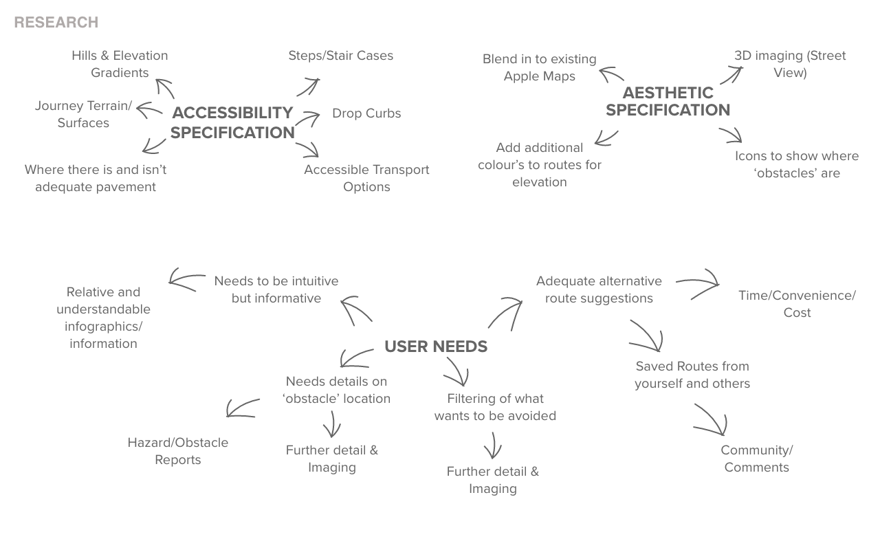
Currently, as a wheelchair user, planning your journey requires using multiple platforms: Google Maps street view, reading reviews, looking out for other accessibility reviews and comments, or calling ahead to places of destination. This is the case for the majority of individuals with specific accessibility needs or mobility issues.
While it is possible, it is time consuming and often requires multiple platforms. This uncertainty of accessibility will often put people off going out and exploring new places.
“I find exploring new places and cities quite daunting. Being wheelchair dependant it’s hard to know exactly what routes are accessible to me without doing some prior research. I find this inhibits my spontaneity and can often put me off.” Research questionnaire participantCheck out my UX article on Medium here
Brainstorming
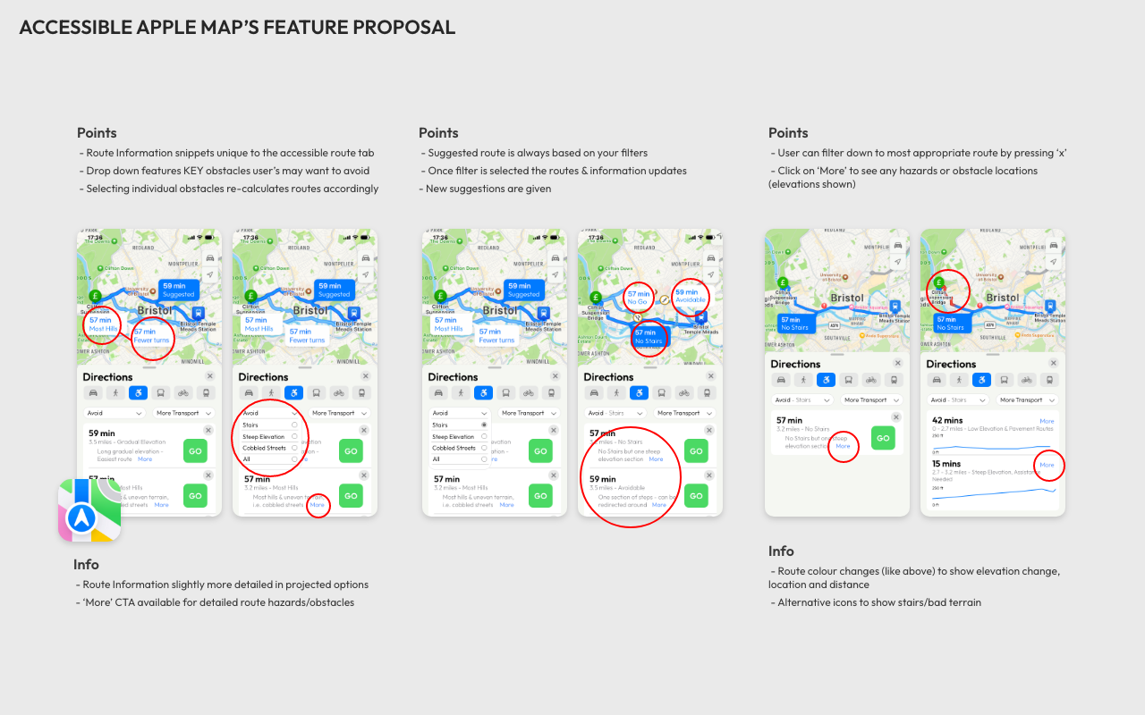
Key features
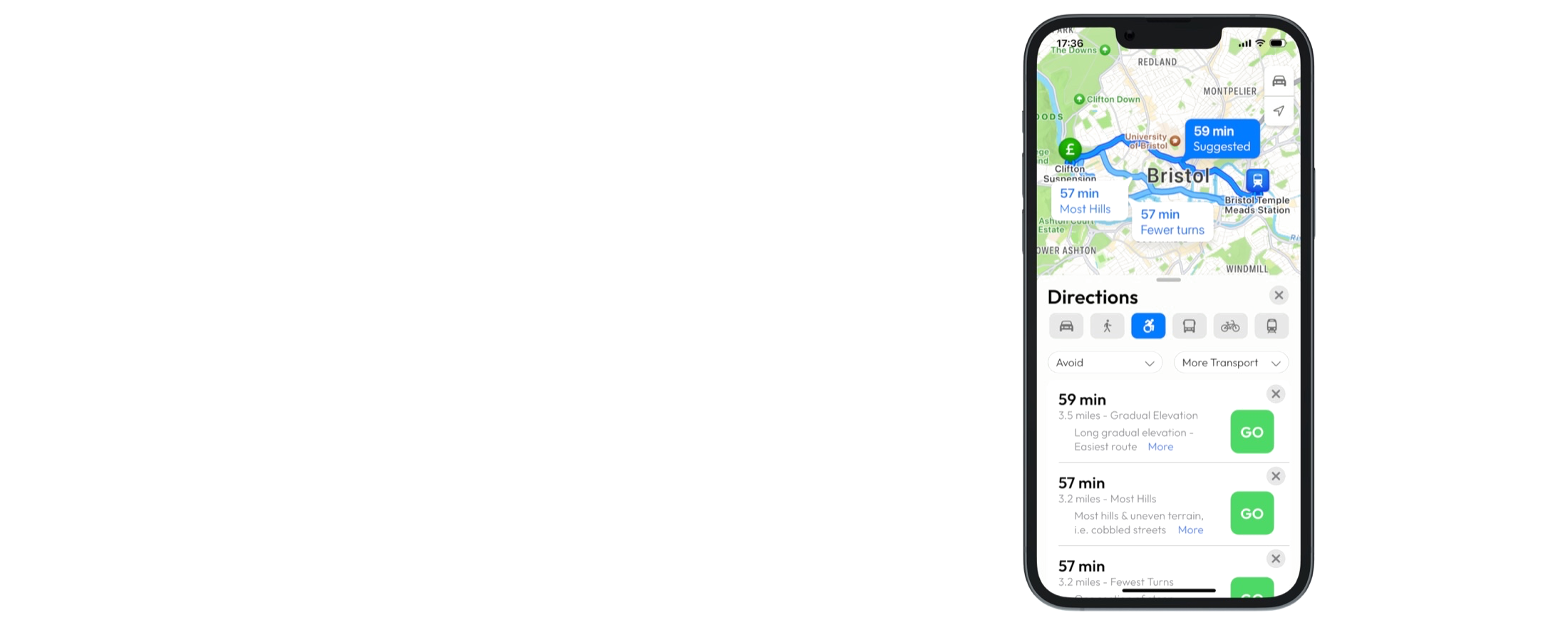
Accessible filter
This needs to be selected in order to access all of the necessary filtering and route options that are available.
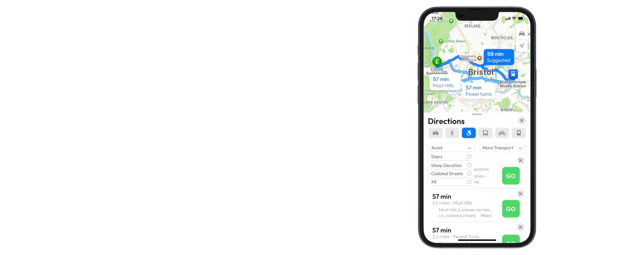
Avoid obstacles
Select from a list of potential obstacles to avoid on your desired routes. These can be specific from individual to individual.
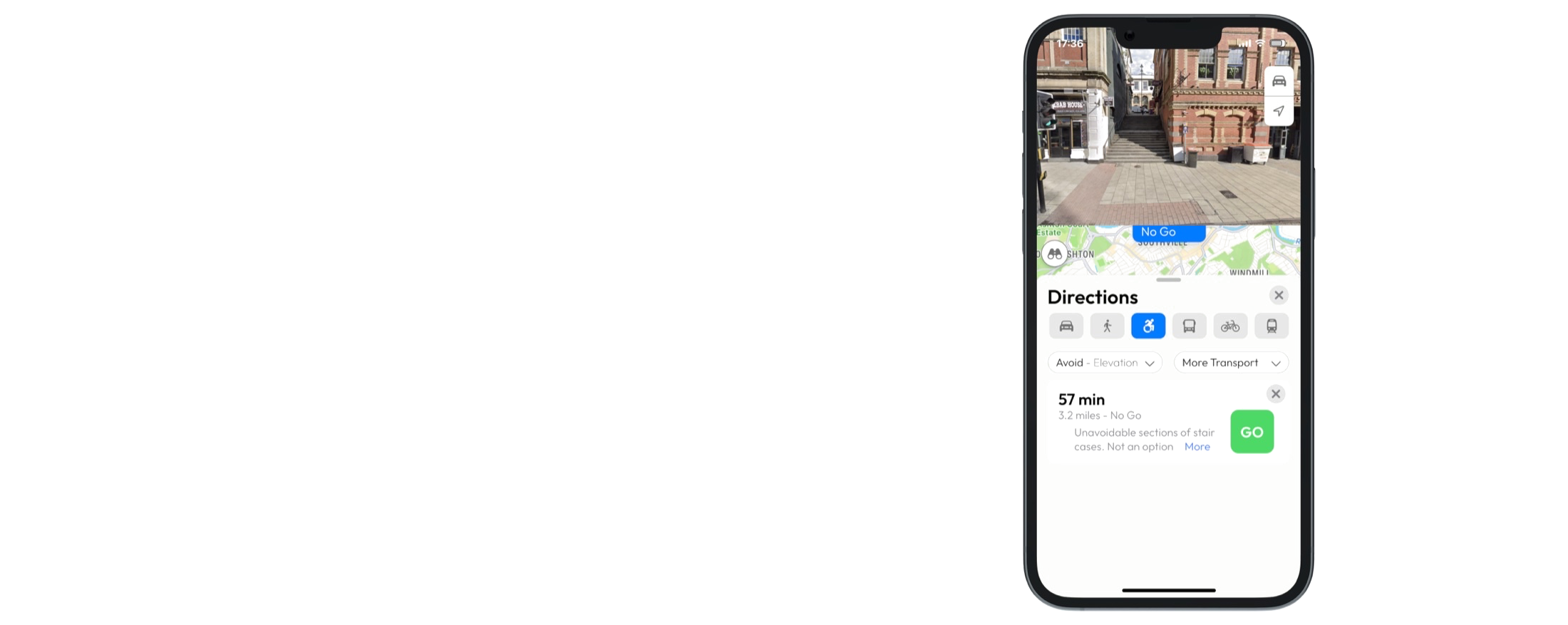
Street view
Use street view imagery to assess your routes and any highlighted potential obstacles.
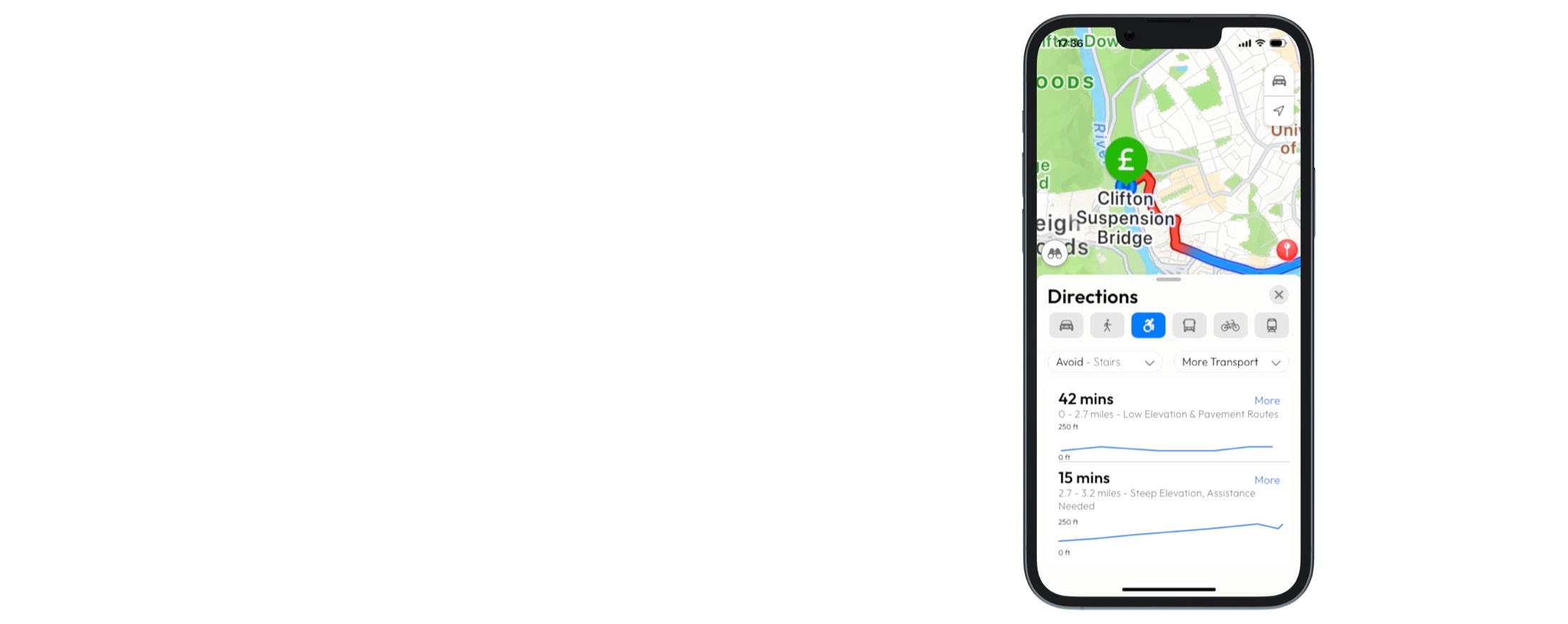
Highlighted elevations
Extreme elevation gains highlighted on route, with a detailed breakdown of distance and elevation gain.
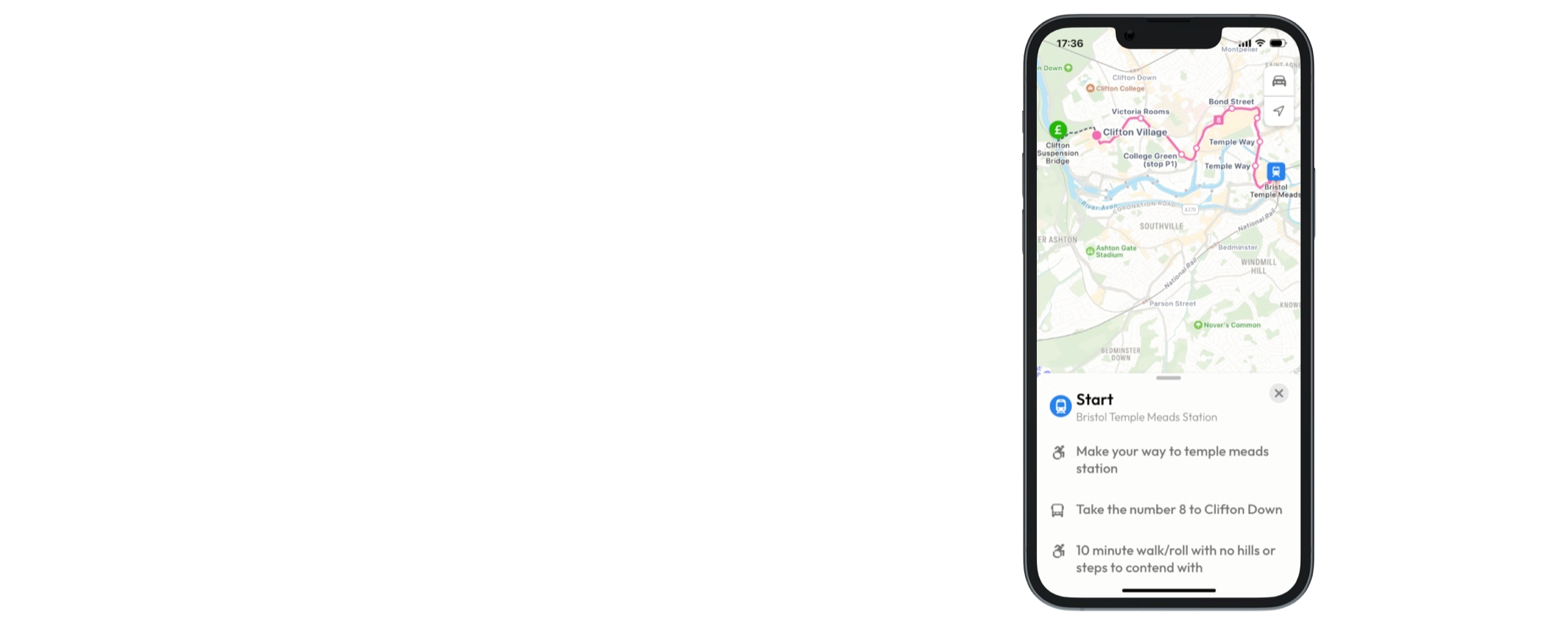
Accessible public transport routes
A more detailed breakdown of public transport options that integrate your chosen obstacles to avoid.